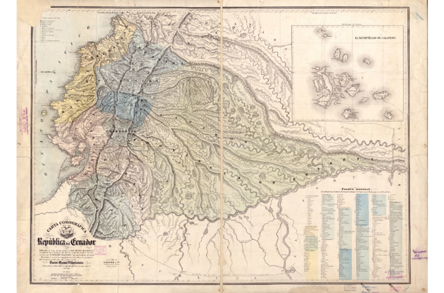
During the Nineteenth century Ecuador was divided by caudillos the same as much of the rest of Latin America. They demonstrate where the largest population clusters were during the time and where the largest cities would be in the future such as the capital Quito located in Pichincha.
The uncolored parts of the map demonstrate the map demonstrates mountainous regions of Ecuador which where widely unused during this time as they did not provide as much to their economy. Unlike other countries in Latin America which thrived from the mining of Gold and Silver Ecuador has almost always been a mineral desert.
The regions densely populated are a direct result of export-based economy that Ecuador maintained during the 19th century. Agricultural exports were the primary focus of Ecuador during the 1800s with cacao and sugar being grown. The extreme heat of the climate was very beneficial for the growing of these crops.
The geographical features such as the many volcanoes and the proximity to the coast facilitated the production of these plants and made the economy of Ecuador highly dependent on agricultural production. The volcanic activity of the country makes the soil highly nutrient rich and fertile. The Coastal plains of Esmeraldas is historically significant as that is where the native people of Ecuador farmed after the independence of Ecuador in 1822.
